 Admin
Admin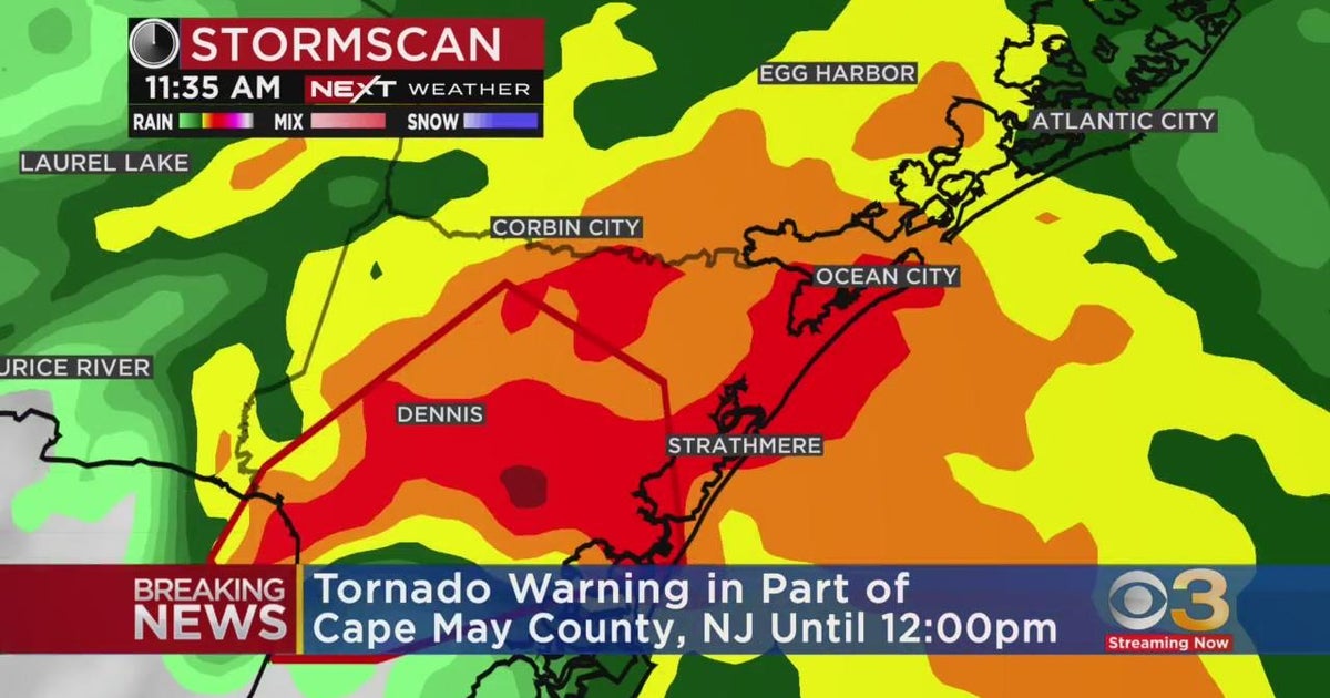
CAPE MAY, New Jersey — A tornado warning has been issued for Cape May County as severe thunderstorms impact the region, prompting weather officials and emergency authorities to urge residents to take immediate safety precautions.
The National Weather Service (NWS) is monitoring a storm system showing signs of rotation that could produce tornado activity, damaging winds, and hazardous conditions. Residents in affected areas are advised to remain alert and seek shelter while the warning remains active.
Severe Weather Threat Develops
The tornado warning was issued after weather radar detected indications of possible rotation within a line of strong thunderstorms moving through the area. Meteorologists continue analyzing radar data to determine the storm’s strength, movement, and potential impact.
Emergency alerts have been issued to notify residents of the developing threat, with officials emphasizing the importance of taking warnings seriously as severe weather conditions can change rapidly.
Current Storm Conditions and Monitoring
Weather officials are continuing to track the storm using Doppler radar and other monitoring systems to identify any signs of strengthening rotation or possible tornado formation.
Local emergency management agencies are coordinating with weather officials as they assess potential hazards, including strong winds, falling trees, power outages, and flying debris.
Residents are encouraged to avoid unnecessary travel while the warning is in effect and to remain aware of additional alerts or updates from official sources.
What the Tornado Warning Means
A tornado warning indicates that a tornado has either been observed or that radar has detected conditions capable of producing tornadic activity. Unlike a watch, which means conditions are favorable for tornado development, a warning means immediate action should be taken.
Residents in the affected area should prepare for possible:
- Damaging wind gusts.
- Fallen trees and branches.
- Power interruptions.
- Flying debris.
- Sudden changes in weather conditions.
Safety Steps During the Warning
Residents should take the following precautions:
- Move to an interior room on the lowest floor of a sturdy building.
- Stay away from windows, doors, and exterior walls.
- Protect yourself from flying debris if possible.
- Avoid traveling until the storm threat has passed.
- If driving, seek shelter in a secure building rather than attempting to outrun the storm.
- Continue monitoring official weather alerts for updates.
Ongoing Weather Response
The tornado warning for Cape May remains an active weather situation, and conditions may continue to change as the storm system moves through the region.
Residents are urged to follow guidance from the National Weather Service, local emergency officials, and other verified sources until the warning has expired.
Staying informed and taking immediate precautions remain the best ways to reduce risk during severe weather events.
Disclaimer:
The information provided on this website is for general information purposes only. While efforts are made to present accurate and timely information, not all details may be verified, complete, or accurate. Weather conditions, warnings, forecasts, and emergency information should be confirmed through the National Weather Service, local authorities, or other official sources. This website does not guarantee the accuracy of all published information and should not be considered an official source of confirmation.
